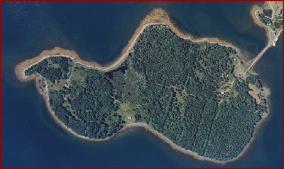
The Oak Island cul de sac
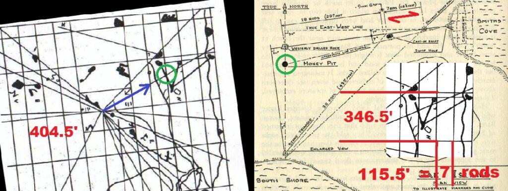
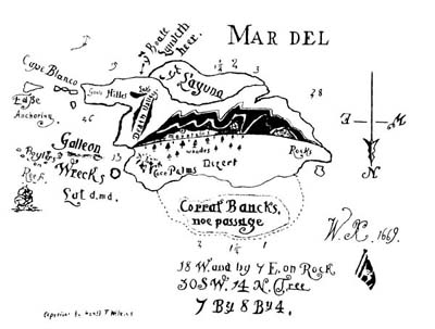
Hedden traveled to England to discover how it was that Wilkins had the same measurements in his book as the layout rediscovered on Oak Island. Wilkins, who had found Lord George Anson’s file in the British Museum years earlier, had been perpetrating a hoax/riddle known as the ‘Captain Kidd Treasure Charts’ in which he was placing real details about the lost treasure’s identity. Hedden went to interview Wilkins and it was something of a shock to Wilkins that Hedden had stumbled across this. Wilkins, on the spot, made up an incredible story about being the re-incarnation of Kidd. Hedden accepted it and went back to Oak Island. It just shows the credulity of those who fell for the Captain Kidd’s Treasure Chart hoax!
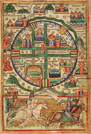
Medieval map of Jerusalem
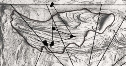
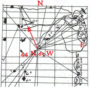
Captain Allen's mysterious map
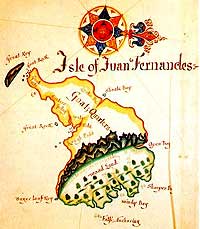
About 1870 a man appeared in Nova Scotia searching for a treasure. Known as Captain of ‘Texas’ Allen due to the Texan style hat he wore, he would hire a local boat for the summer season. Each day he would have the ship sailed to a starting point, 44N 63W, which about 30 miles off Nova Scotia in the Atlantic Ocean. He would then check his position using the sun and direct the boat to sail in a northwest heading. Captain Allen had a map which the boats crew would peek at when given the chance. It was described as being ancient with many lines upon it and had some words written on it in a ‘foreign’ language. There was an island shown and marked on the island was a triangle that was interpreted to be representing three stone cairns.
Captain Allen told the crew he was searching for the island upon which was buried a fabulous treasure. He was a rich man and didn’t care for the wealth but finding the treasure would benefit all mankind. He conducted the search for two seasons before giving up. He gave the map and directions to a local man named Pickles. It was agreed by the locals that the directions Captain Allen was using should have taken him to Oak Island however as he didn’t make an allowance for the magnetic variation in the area his compass heading was always slightly out and he kept missing it.
The important point about Captain Allen is that it demonstrates he knew how to follow the map; start from the map’s central datum point ( here 44N 63W) and sail the Antares/245 bearing to find the island. Unfortunately Masonic influences were a bit overwhelming by the 1870s and these tended to obscure the real details about their ‘Lost Word’. Captain Allen had his map oriented so that what was really North was now pointing East. To sail the Antares/245 bearing required you to then head in a northwest direction.
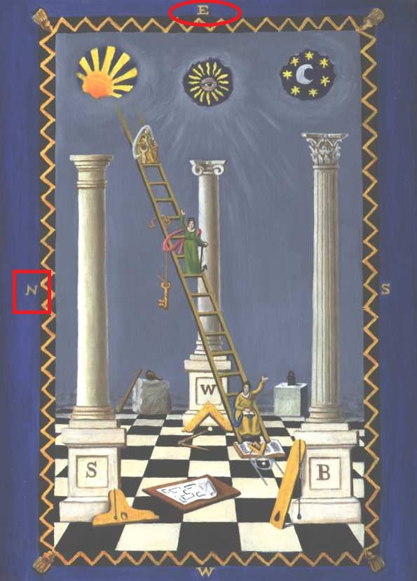
The accepted convention for modern maps is to have the direction North at the top. Freemasons however place East at the top of their maps. This is a leftover from medieval maps of Jerusalem which placed the Jerusalem Temple (King Solomon’s Temple) that on the eastern side of the city at the top of the map.
To use a Masonic map you have to then make ‘North same as East’, in other words turn the map 90 degrees clockwise.
Which is exactly what Captain Allen did!
Whoops!
The Beale Ciphers
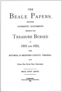
Again, the whole thing was a riddle that gave details to the treasure. With signals in it meant to be identified and solved by brother Freemasons it was also designed to hoax and confuse all others. It sets out a complete backstory about a man named ‘Thomas J Beale’ who supposedly left a series of coded letters with an innkeeper that gave the location of a large cache of treasure. The story expands out to relate the attempts made to unlock the letter’s code when ‘Beale’ failed to return to recover the cache. The story tells that one of the letters manages to be decoded when the code’s key is discovered to be the 1776 Declaration of Independence. The decoded letter allegedly lists the treasure.
The Beale Ciphers are easily solved once you know what the authors were doing and why they were doing it. Here are the pointers to understand this riddle and the message it is really giving. Just look at it all as a late 19th century Freemason would have.
In 1885 the story would have been a bit more recognisable as having been a construct as it just incorporated its material from other sources. Below on the left is the supposed text of the decoded Beale letter that lists the treasure. On the right is the text from another story also popular at the time that is known as the ‘Treasure Mountain Cache’.
Beale Cipher decoded letter 'Number 2'
I have deposited, in the county of Bedford, about four miles from Buford’s in an excavation or vault, six feet below the surface of the ground, the following articles, belonging jointly to the parties whose names are given in number “3” herewith:
The first deposit consisted of one thousand and fourteen pounds of gold, and three thousand eight hundred and twelve pounds of silver, deposited November, 1819, The second was made December, 1821, and consisted of nineteen hundred and seven pounds of gold, and twelve hundred and eighty-eight pounds of silver: also jewels, obtained in St. Louis in exchange for silver to save transportation, and valued at $13,000.
The above is securely packed in iron pots, with iron covers. The vault is roughly lined with stone, and the vessels rest on solid stone, and are covered with others. Paper number “1” describes the exact locality of the vault, so that no difficulty will be had in finding it.
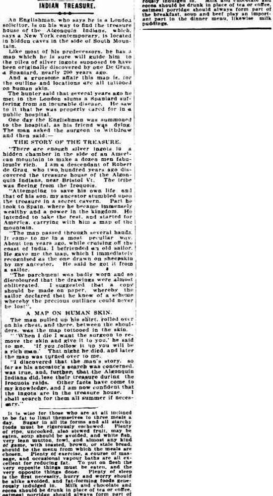
Treasure Mountain Cache story
If you read about the Beale Ciphers today you will find the name is given as ‘Thomas Jefferson Beale’, but nowhere does this appear in the 1885 pamphlet, the name is only given as ‘Thomas J Beale’. This occurred as the name got unconsciously expanded in the retelling due to the little trick of the authors inducing readers to assume it by mentioning the Declaration of Independence that was, as everyone knows, drafted by Thomas Jefferson in 1776. The important number for solving the mathematical part of the riddle is 76, really the factors 7 and 6 being written together. Of course you know Hermes Trismegistus wrote 42 books of arcane knowledge about 6 subjects. You’ll also find 7 and 6 written on Marie Hautpoul’s gravestone also for the lost treasure mystery known as Rennes le Chateau. As everyone knew 7 x 6 is 42, the magic cipher of latitude that Freemasons were trying to fathom back then.
Thomas Jefferson himself is the clue to all this, a surveyor by trade he had a home in Bedford County in Virginia. In 1813 he surveyed a group of three hills there known as the Peaks of Otter to determine if they were the highest mountains in the United States. They weren’t the highest but it was found they did have a unique feature. The three Peaks of Otter, comprising of Sharp Top Mountain, Harkening Hill and Flat Top Mountain, form a near perfect equilateral triangle. Could this be the ‘Cerro tres Puntas’, the ‘Hill of Three Peaks’ that Freemasons thought were shown on the monument map and were the location for the lost Ark of the Covenant?
The mathematical riddle to be solved is in the section shown in red in the text above of the ‘decoded letter’ above. The giveaway is that it states ‘the first’ and ‘the second’ being the two values to be extracted for latitude and longitude (remember everything is based on the map). The signal being given is the Coniunctio, the ‘addition of the opposites’, as it states gold and silver. Recognise the symbolism?
Simply add the opposites of gold and silver together and divide the total by the key number of 76. Here are the worked formulas with the symbols for gold and silver added for clarity.
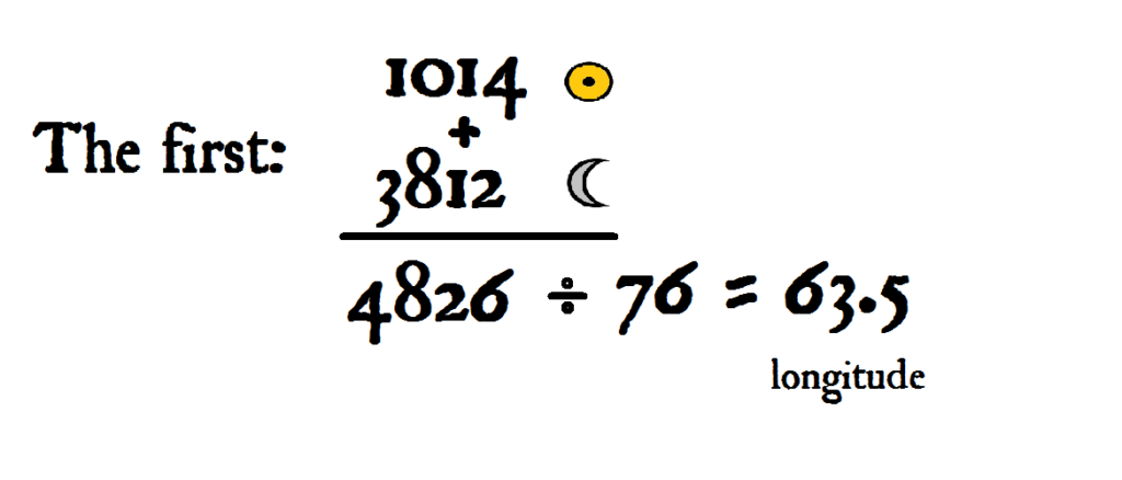
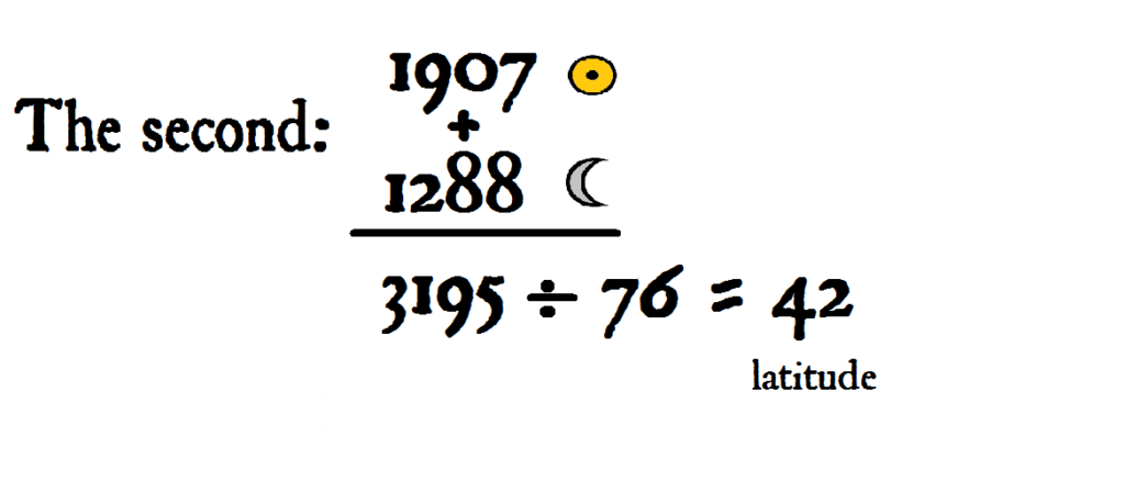
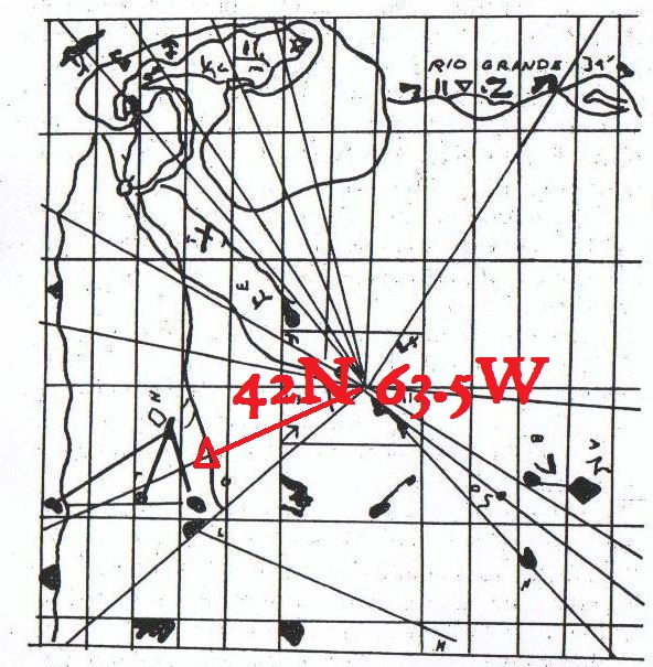
This gives you the position in the Atlantic Ocean for the map’s central datum point. By following the 245 degree Antares bearing you will head towards Bedford, Virginia and find eventually what they thought was the ‘Cerro tres Puntas’ marked on the map, the three Peaks of Otter.
The author’s motive and strategy is disclosed by the final two paragraphs of the story’s narrative that tends to be left out of shortened modern recounts. They were trying to alert other Freemasons they had found the Cerro tres Puntas.
“I anticipate for these papers a large circulation, and, to avoid the multitude of letters with which I should be assailed from all sections of the Union propounding all sorts of questions, and requiring answers which, if attended to would absorb my entire time, and only change the character of my work, I have decided upon withdrawing my name from the publication, after assuring all interested that I have given all that I know of the matter, and that I cannot add one word to the statements herein contained.
The gentleman whom I have selected as my agent, to publish and circulate these papers, was well known to Mr. Morriss; it was at his house that Mrs. Morriss died, and he would have been one of the beneficiaries in the event of my success. Like everyone else, he was ignorant of this episode in Mr. Morriss’ career, until the manuscript was placed in his hands. Trusting that he will be benefited by the arrangement, which, I know, would have met the approval of Mr. Morriss, I have left the whole subject to his sole management and charge. It is needless to say that I shall await with much anxiety the development of the mystery.”
James Beverly Ward (a Freemason), who as the ‘agent’ arranged the publication of the booklet and whose name appeared on it, acted as the contact point and filter. A letter from anyone believing the Beale Cipher story to be real and claiming a solution would just be disregarded.
It seems their strategy did work and this led to them eventually being informed of the error of their ways by some other Three Point Brother more knowledgeable of locational clues than they for there are no references to any searches for the treasure on the Peaks of Otter.
The Beale Cipher though is just the most well known version of the story of the lost treasure being on a mountain. Another version, this one from 1903 and placing it on South Mountain in Vermont, has a lot more recognisable components in its makeup.
